Regional data
Regional statistics offers data relating to units of area, settlements, about economic, social and environmental phenomena, processes, respectively contributes to regional impoundment. The goal of regional statistics is to provide reference, information for users by making public regionally detailed data originating from the HCSO data collection system, as well as data and information taken over from external bodies. It incorporates detailed and comprehensive statistics about the situation and development of regions, counties, districts, settlements and units of area outside administrative boundaries (e.g. in-settlements georeferenced data).
Key figures
Natural decrease per one thousand inhabitants
Indicator description
Employment rate
Indicator description
Unemployment rate
Indicator description
GDP per capita
Indicator description
Featured
Regional Statistics, Volume 16, Number 3, 2026

Day of Szeged
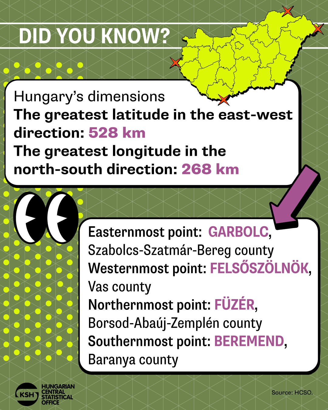
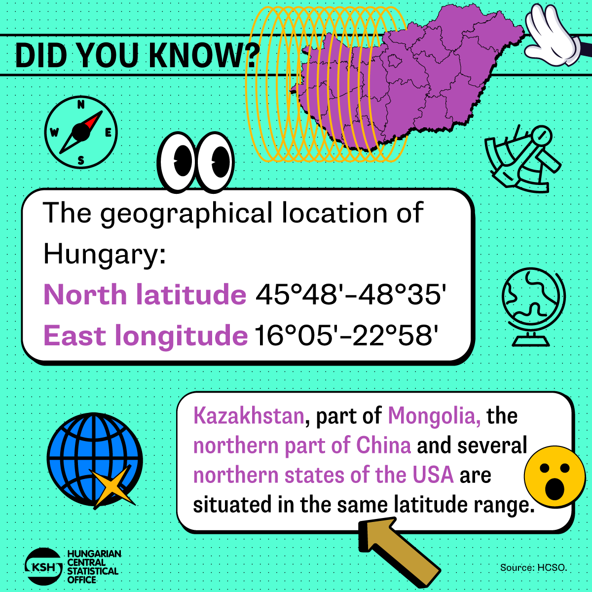
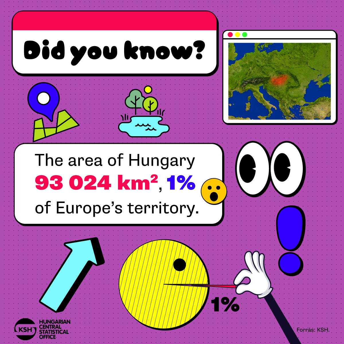
Did you know? – Hungary’s dimensions
The greatest longitude in the north-south direction: 268 km
If you liked it, check out our data visualisations at this link: www.ksh.hu/datavisualisations
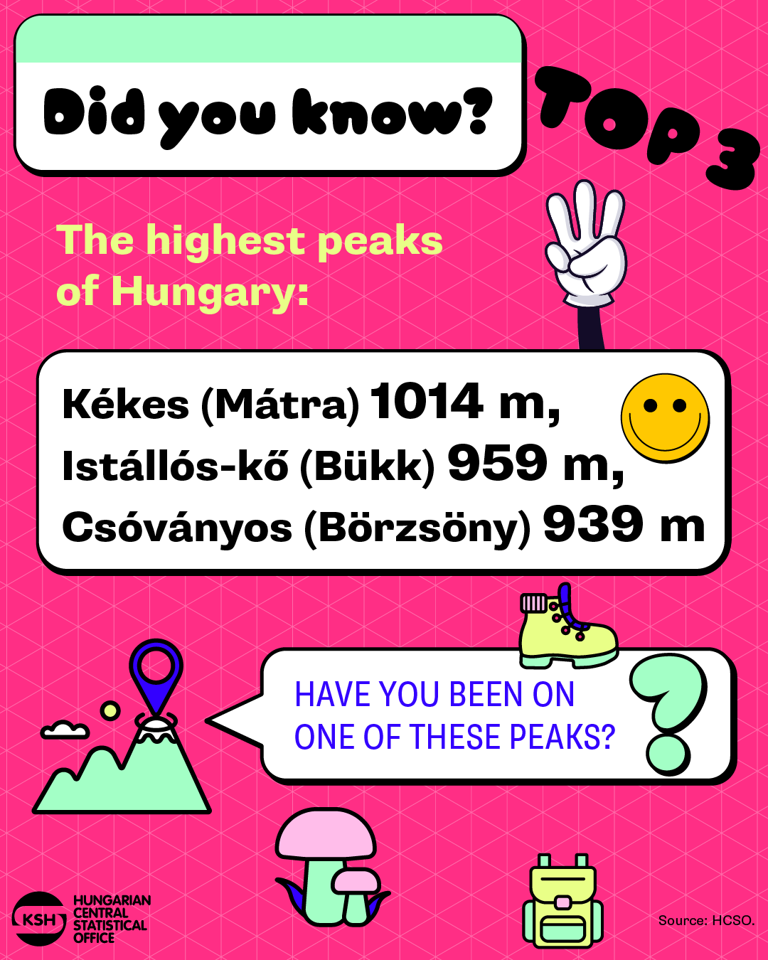
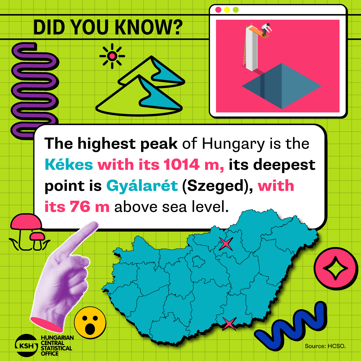
Did you know? – The highest peaks of Hungary
Hidas-bérc (Mátra) 971 m,
Galya-tető (Mátra) 964 m
If you liked it, check out our data visualisations at this link: www.ksh.hu/datavisualisations

Parliamentary Elections

TÉR-KÉP, 2024 – Countries of the Visegrad Cooperation (V4)

Regional Statistical Yearbook of Hungary, 2024

Statistical Yearbook of Hungary, 2024
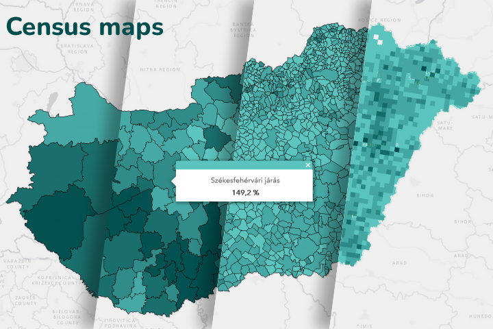
Census Maps
Annual settlement statistics database (T‑STAR)
It collects the main numerical information on all settlements in Hungary from the aspect of settlement statistics, in time series and categorised by group of themes.
Budapest districts database (BP‑STAR)
It collects the main numerical information on Budapest districts, in time series and categorised by group of themes.
Regional atlas
It presents administrative and statistical territorial units, the results of categorisations and delimitations, as well as smaller territorial units. Moreover, it provides an outlook on the territorial classification of the European Union, the NUTS system.
Detailed Gazetteer of Hungary
It is a repository of the administrative classification of settlements and of changes in regional structuring, including basic data on localities, major census data, and the characteristics of parts of settlements by postal code and by character of settlement.
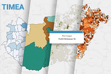
Interactive mapping visualisation application (TIMEA)
With TIMEA application, thematic maps can be made for different territorial levels in Hungary. Many setting and filtering options help visualise statistical data. The data are available and downloadable going back for several years, and a methodology helps interpret them.
Counties in focus
This Hungarian-language publication informs quarterly on the socio-economic situation of the capital city as well as the 19 counties. With its maps, charts, analyses and tables, it provides an opportunity to review the different themes and also to compare them by county.
Related themes
- Agriculture
- Censuses
- Construction
- Culture, sports
- Education
- Environment, public utilites
- Health care, accidents
- Housing
- Industry
- Information, communication
- Internal trade
- Investment
- Justice
- Labour
- National accounts, GDP
- Population and vital events
- Science and technology
- Social care protection
- Tourism, catering
- Transport
Methodological information
Related links
Release and revision calendarPublication repertory
Dissemination database ( infra-annual data annual data ) |
Latest update | Next update |
|---|---|---|
Local area statistics / Settlement and district statistics | ||
| Annual settlement statistical data | 03/06/2026 | – |
| Data of functional urban areas (Urban audit) | 25/02/2026 | – |
| Data of urban area centrum (Urban audit) | 25/02/2026 | – |
| Annual statistical data by Budapest districts | 22/01/2026 | 01/07/2026 |
| Population census data by Budapest districts | 02/07/2024 | – |
| Population census in territorial breakdown in 2022 | 02/07/2024 | – |
Census data |
Census |
|---|---|
| 6. National and county data | Population census 2001 |
| 18. Demographic data | Population census 2001 |
| 21. Data on statistical subregions | Population census 2001 |
Data visualisations